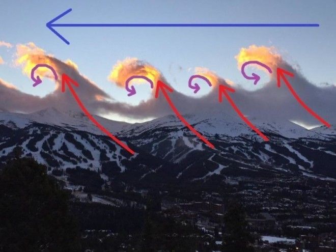
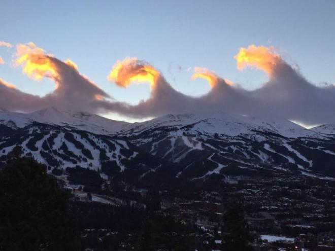
BEST Kelvin-Helmholtz (or, “KH”) clouds I have EVER seen. This picture was taken last Friday by Breckenridge ski resort in Colorado, about 80 miles west of Denver. At first, I’m not sure they knew exactly what they had captured, other than a stunning cloud formation, when in reality they captured what many meteorologists are calling “unbelievable, jaw-dropping, and unforgettable.” Almost sounds like a movie review!
So what are Kelvin-Helmholtz clouds and how do they form? Also known as “billow clouds,” these form in unstable atmospheres with VERY strong winds, and especially when there is wind shear present. Wind shear describes air moving at different speeds and/or directions with altitude. I’ve annotated this image to illustrate how exactly these formed. Air was forced up the steep mountains (called “orographic lift”) which formed the clouds. Strong winds aloft (moving right to left in this image) exerted force on the top of the cloud causing part of it to collapse or curl forward. This allows the cloud formation to take on a wave-like appearance.

Examining the picture closely, is there any wonder that our atmosphere is a fluid? The atmosphere (made up of mostly water and other gases) simply moves, glides, and responds to what to the forces around it, in this case the towering mountains of the Colorado Rockies and strong winds aloft. Watch this video of the clouds in action: Watch: Wave clouds captured over Colo.
While these types of clouds are most common near mountain ranges due to the topographic influences and strong winds at high elevations, they can be seen anywhere. In fact, I’ve seen them in the Great Plains on several occasions on potential severe weather days. After all, they indicate wind shear in the atmosphere – a necessary ingredient for severe storms – and therefore can be used as a forecast tool for storm chasers!
The sunset illuminating the highest tips of each individual wave-cloud high in the atmosphere adds to the dramatic effect of this picture. Also, the high elevation at which this picture was taken likely played a role in how HUGE the clouds look. Typically these clouds exist very high in the atmosphere appearing much smaller to the naked eye. However, Breckenridge’s elevation of around 10,000 feet (depending on where you are) puts us that much closer to the clouds thus making them appear larger-than-life!
Breckenridge is set to open on November 13 where avid skiers hope to ski, or rather “surf,” the white-powdered slopes well into Spring of 2016. I’ve told you that these are the best Kelvin-Helmholtz clouds I’ve ever seen, but don’t take it from me. Take it from a world-renowned meteorologist who’s been around the block a few times, and who’s seen his fair share of amazing weather over the years, Jim Cantore. Marveling at this photo with me Tuesday he exclaimed spellbound, “those are the BEST “KH” clouds I have EVER seen!”

